Horton to Ribblehead
Walk 14 - Horton to Ribblehead - 8 miles - 4.5 hours - by train or car starting from Horton Station finishing at the Station Inn Ribblehead . A very easy walk with no serious hills passing a few interesting features along the way. An excellent alternative for low cloud level or those with an aversion to hills! If arriving by car park in the public carpark in Horton or roadside leading from the village to the station. Back to Ribblehead
 |
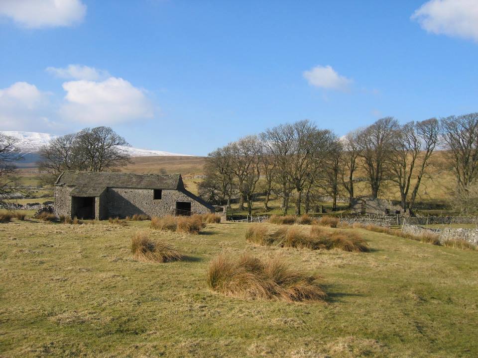 |
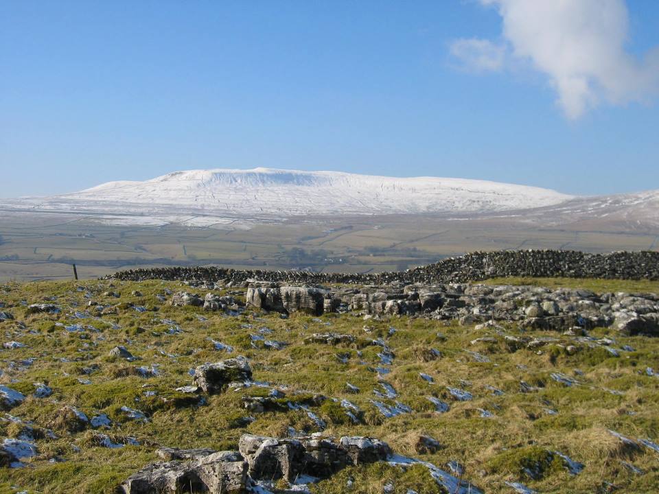
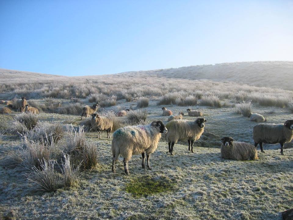
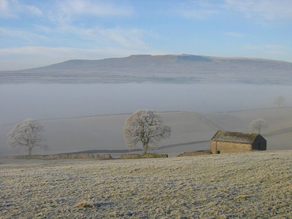
| Winter views from the path to High Birkwith | Barn at Thorns |

Starting from the station proceed towards the village crossing the first river bridge and passing along the Pennine Way track to the right hand side of the Crown Public House. The track bears left and climbs slightly uphill for a while.
Eventually Sell Gill Holes will be reached comprising two pot holes one of these having an impressive waterfall in spate. Shortly after the gate look for a grassy track bearing left as the Pennine Way climbs further uphill. Walk along this for a short way crossing from the right hand to the left side of the dry stone wall and over a stile, This path continues on the level passing a well preserved lime kiln on the right in the scar. The the views are pleasant but otherwise uneventful until approaching a group of trees [in fact a ravine]. At this point turn sharp right up hill around the top of the ravine and joining one of the main 3 peaks paths from Pen y ghent passing through stile at the side of a gate just above High Birkwith farm.
 |
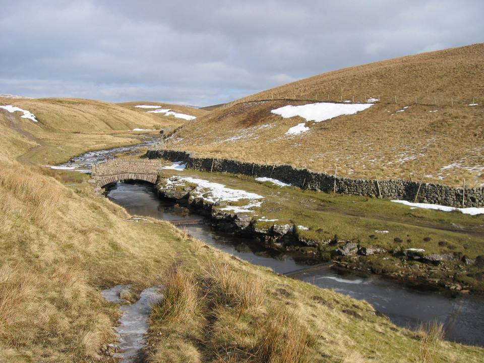 |
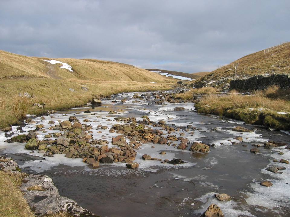
| Pot hole near Old Ing | Ling Gill Bridge |
Note - to take a short cut to Nether Lodge [missing out Ling Gill] - immediately after crossing the farm road drop down a grassy slope crossing a stream on a plank bridge, rounding the hill and continue on the level across grassy pasture. In a short time a stile is reached. The stream at this point passes below the path through a natural formation known as Gods Bridge. The path continues thence to Nether Lodge where an unusual timber footbridge has recently been constructed avoiding the farmyard.
However, if intending to take the more interesting Ling Gill walk bear slightly right along land rover track passing through gate to the left of Old Ing Farm. Immediately through gate take the left hand track and another gate with 'no vehicle' sign.
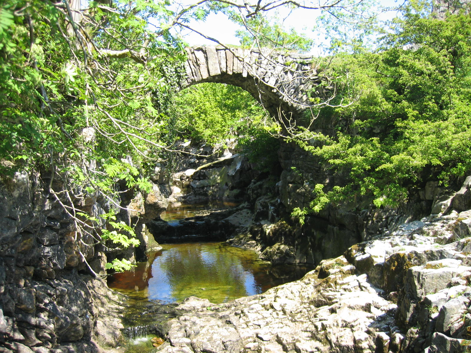
The track winds its way past a barn and Calf Holes pothole to meet Ling Gill a 150ft deep limestone ravine and nature reserve to the left of the track. The reserve can be accessed over a style although extreme care must be taken and in fact it is difficult to see the bottom of the ravine. In April/May this will have many Early Purple Orchids. Proceeding still further along the track the stream [in fact Cam Beck] is now level and the recently restored Ling Gill Bridge comes into view. This is always a good place to stop!
 |
 |
| Ling Gill Bridge | Above Ling Gill Bridge |
 |
 |
| Winter view near High Birkwith | Winter view near High Birkwith |
Cross the bridge and return along the other side of the beck bearing right with the wall on the left. After 500m or so turn left across a style by a ruined barn. Follow the drystone wall on the left emerging on to more open pasture. From here it's almost a straight line downhill to Nether Lodge [where the short cut alternative is met]
Shortly after the farm [along the farm track] there is a sign post to Thorns / Gearstones. Follow the faint path across which across undulating rough pasture meeting a stile across a wire fence, a stream and then a gate in the corner of the pasture. After the gate look out for a stone barn. To the left of the stone barn there is a stile. Crossing the stile continue with the wall and the barn on the right. Over the small hill the deserted farmstead of Thorns is reached. After the first barn turn left along a walled track which curves then to the right crossing a field dropping down into Thorns Gill an attractive limestone ravine with a precarious stone bridge crossing it.
 |
 |
| Thorns Barn | Thorns Gill Bridge |
Crossing the bridge climb up the hill and across the field and straight on through two stiles/gates to meet the main Hawes - Ribblehead road. Turn left and walk along the road to reach Ribblehead.
Important note:- Whilst the author has taken every care in assembling the information on this site, no responsibility can be accepted for any error or omission herein. If in any doubt walkers should always consult the relevant OS map. All timings are approximate and for a person of average fitness and ability.
©John Carey 2010
This page was last updated on 13-May-2020